Asset Management

MM Survey offers solution for virtual asset management

Test

Benefits

Your organisation will benefit by implementing Asset Management System

  • Reduced cost by limiting site visits
  • All documentation in one place
  • Easy to use without training
  • Direct link from As-built documentation to direct view

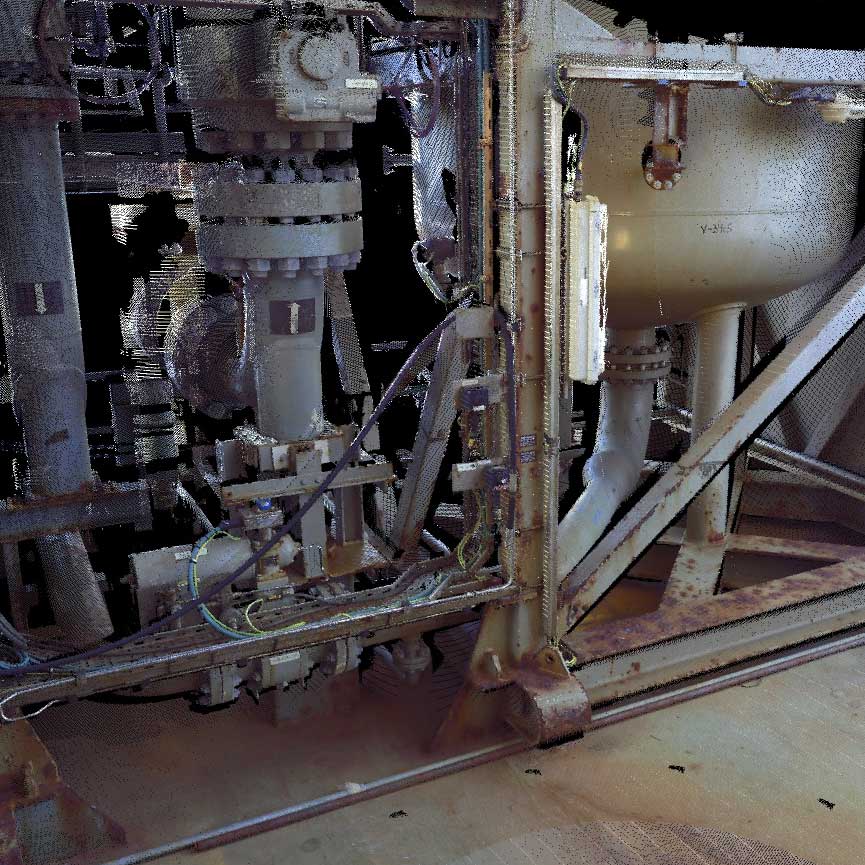
Photographic documentation of the asset will allow for quick site visit.

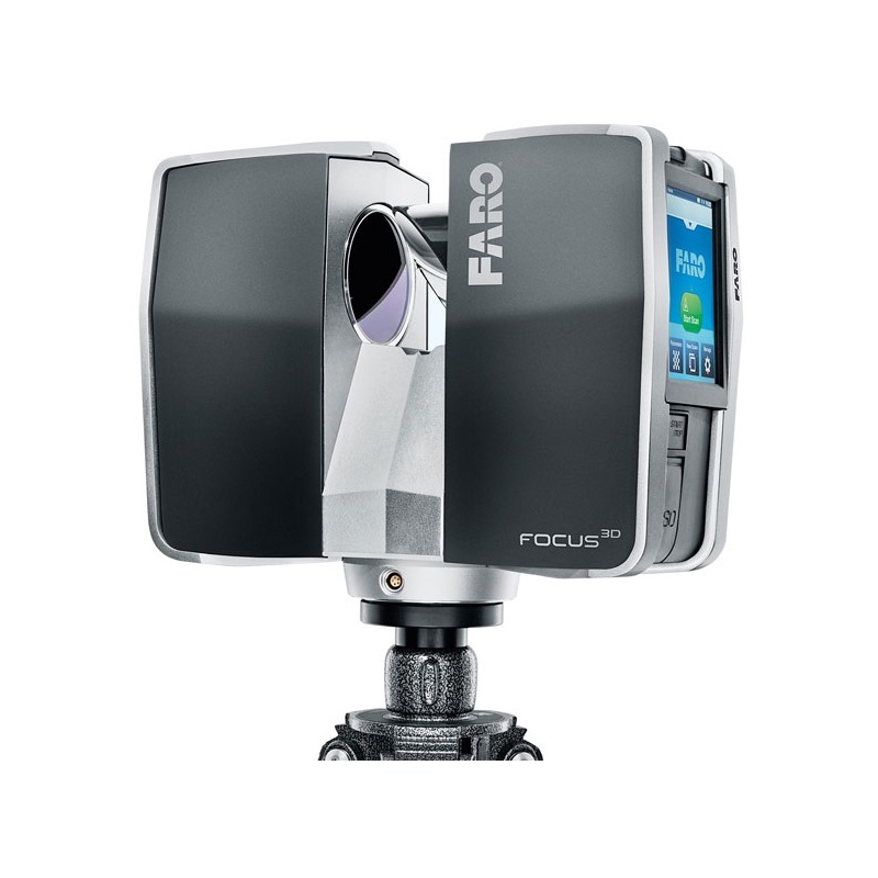
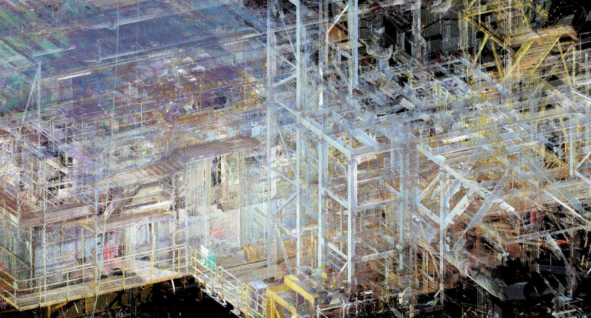
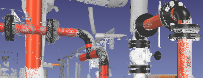
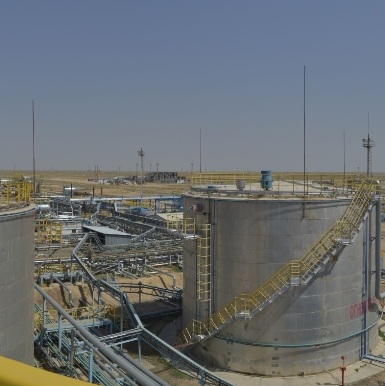
MM Survey has special experience and competencies in capturing and processing the data on the offshore and onshore installations.

Test
Test

Turn-key solution

MM Survey delivers high quality 360° panoramic images linked together into walk through environment. Plan drawing of the facility is linked with the images to ease the navigation.

After successful deployment, end users can interact with the virtual world by uploading PDF documentation, images and text. This will allow to build a virtual environment with all documentation in place. MM Survey can assist by publishing the documentation on top of the virtual tour, but this process can be done as well by client personnel.

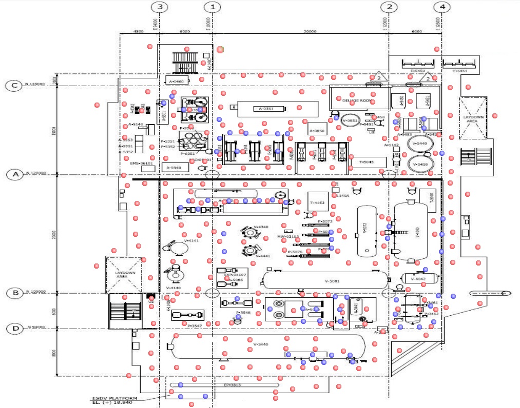
In order to reduce time used to search for the asset inside virtual environment, link from the design drawings like P&ID or PFD can be made. Our team will do a line walk to see it the piping fits to the design drawing and link each component with the view inside virtual tour. That way the owner of the facility and contractors will be able to find necessary information with no time.

End product can be deployed locally as a stand alone application or through the network. It will run on IE9 and above and other modern web browsers.

Asset Management System has proved to be a valuable resource in many aspects such as:

  • Preparation of the projects
  • Communication between departments
  • FEED Studies
  • Familiarisation and induction training

Laser Scanning

MM Survey offers high quality 3D laser scanning for a variety of purposes both onshore and offshore

Test

Technology

In MM Survey we use the newest technology and state­of­art equipment. MM Survey has two Faro Focus 3D laser scanners, that are ideal for fast and high precision scanning.

3D laser scanning is especially well suited to solve tasks in the oil & gas industry including offshore platforms, refineries and various process plants. Also the construction industry can benefit from precise as­built documentation from a laser scannning.

MM Survey has special experience and competencies in offshore scanning in the Danish sector of the North Sea. Here MM Survey has executed a range of scanning projects for major operators in the oil & gas industry.

Test
Test

Processing of scanned data

The resulting point cloud from a scanning, which consist of millions of points, is post ¬processed with our dedicated software like Leica Cyclone and Kubit Point Sense Plant.

This software offers a variety of deliveries for the client. Based on the point cloud MM Survey can deliver a precise solid models of the scanned objects as well as intelligent piping models and isometrics.

MM Survey can also deliver raw point clouds, with the application of colored photographic images, which are easy to use and interpret. More specific calculations of tie¬-in points, rotation and tilt for flanges and pipes in a process area, are also among MM Survey main competencies.

We can also transform local coordinates into a specific coordinate system, like the coordinate system on a offshore platform according to the overall module line system. For this we often combine scanning and survey with a total station. The resulting models and point clouds can be imported into a wide range of CAD programs used for engineering. Among these programs and formats can be mentioned:

  • AutoCad
  • PDMS
  • MicroStation
  • SmartPlant
  • Navisworks
  • Leica PTX/PTS
  • E57
  • Lfd

Further formats can be delivered.

3D Modelling

MM Survey offers high quality 3D laser scanning for a variety of purposes both onshore and offshore

Test

Technology

In MM Survey we use the newest technology and state­of­art equipment. MM Survey has two Faro Focus 3D laser scanners, that are ideal for fast and high precision scanning.

Captured data can be converted to 3D solid model of piping and structure.

Test
Test

Processing of scanned data

Point cloud is modelled in either Leica Cyclone or Kubit PointSense Plant software.

Modelled piping can be converted into isometric drawing in order to make as-build data

MM Survey can deliver solid model and intelligent piping model in following formats

  • AutoCad
  • PDMS
  • MicroStation
  • SmartPlant

Further formats can be delivered.

Career

MM Survey offers an opportunity to work with the latest technology

Ideal Candidate

Holds degree in Science.

Has 18 to 67 years.

Is willing to learn new things.

Can travel offshore and abroad.

MM Survey can offer

Various projects

Offshore trips

Competitive salary

Contact Us!

MM Survey ApS

10. Juli Vei 1
6070 Christiansfeld
Denmark

+45 60 74 63 38
mm@mmsurvey.dk
Quick contact
Asterysk +48 723 005 735 Contact us!